Vancouver Island Trail: An Island-Spanning Wilderness Trek
The Vancouver Island Trail, a relatively obscure gem, stretches an impressive 800 kilometers from Oak Bay in Victoria to the rugged beauty of Cape Scott at the northernmost tip of Vancouver Island. This ambitious undertaking was brought to life through the vision of Gil Parker and the tireless efforts of numerous volunteers over many years. The sheer length and challenging terrain mean that few individuals have successfully traversed the entire route. For those daunted by the prospect of an end-to-end expedition carrying all necessary supplies, exploring a segment of this remarkable trail offers a more accessible way to experience its diverse landscapes.

Exploring the Northern Section: Suquash to Keogh River
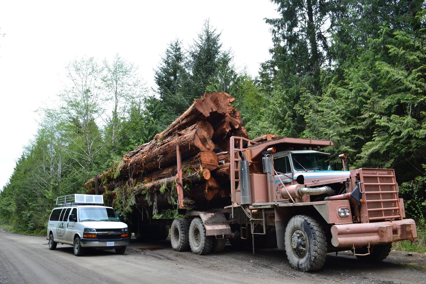
A recent exploration focused on the section of the Vancouver Island Trail extending from Suquash to the Keogh River, situated in the northern part of the island. The journey began by navigating past the historic Suquash Mine site, continuing along a significantly overgrown logging road for approximately four kilometers until reaching the designated trail marker. While the official trail alignment incorporates this logging road, the decision was made to drive as far as feasible. This proved to be an adventurous endeavor, as the extremely narrow and vegetation-encroached road tested the limits of the vehicle, best suited for older, less cherished models. The resulting scratches served as a testament to the wildness of the terrain. The logging road ultimately terminated abruptly in a recently clear-cut area, offering no convenient space to turn around. It was here, atop a fallen log, that a Vancouver Island Trail sign clearly indicated the entrance to a substantial and inviting forest.

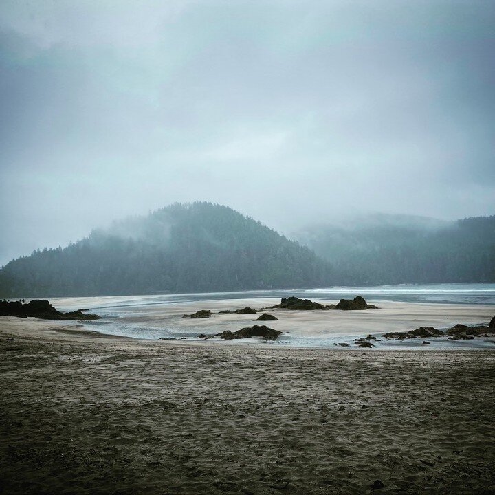
The trail itself meanders along the coastline, remaining just within the tree line. This strategic positioning provides hikers with captivating ocean vistas, complemented by the majestic mainland mountains visible in the distance. The path also winds through a beautiful forest characterized by the presence of some impressive old-growth trees. Despite the relatively level and undemanding nature of this section (especially without the burden of a full backpacking load), progress was considerably slowed by extensive blowdown resulting from recent winter storms. Negotiating the numerous fallen trees and debris proved to be physically taxing. Consequently, the decision was made to turn back at a creek located just south of the Keogh River. The return journey to the vehicles followed the coastline along the beach, where abundant signs of wildlife were evident in the form of numerous wolf tracks forming a veritable highway in the sand, along with frequent scat deposits. Several smaller trails were observed leading from the beach back up to connect with the main Vancouver Island Trail.


Maintenance and Future Prospects
The stewardship of the Vancouver Island Trail is incumbent upon the diligent efforts of volunteers. Due to the substantial resources demanded for the upkeep of such an extensive trail system, coupled with the recent effects of severe wind damage, the clearance of this specific section may be subject to a protracted timeline. Notwithstanding, upon the completion of necessary maintenance operations, this segment is poised to offer an exceptionally scenic and gratifying environment for pedestrian traversal and further exploratory endeavors, thereby presenting a synthesis of littoral vistas and sylvan interiors.